The Duffey Lake Road: What to Know Before Driving Highway 99 to Lillooet

August 21, 2026
The Duffey Lake Road climbs from Pemberton to Lillooet with no fuel, no signal and serious grades. What to expect, when to avoid it and what passes apply.
What's on this page
Highway 99 between Pemberton and Lillooet is one of the best short drives in British Columbia and one of the least forgiving. Roughly 100 kilometres with no services, no reliable cell coverage and grades over 10 percent, past Joffre Lakes Provincial Park where day-use passes and seasonal closures apply.
Most people who drive the Sea to Sky stop at Whistler and turn around. Carry on through Pemberton and the road changes character entirely. Highway 99 climbs east out of the valley, tops out among glaciers, runs beside a lake the colour of antifreeze, and drops into dry sagebrush country at Lillooet where the temperature can be 15 degrees warmer than where you started.
It is about 100 kilometres and it is one of the great short drives in the province. It is also the stretch where drivers who treat it as a scenic detour get into trouble.
What the road is actually like
From Pemberton the highway climbs steeply out of the Lillooet River valley in a series of switchbacks with grades over 10 percent. There are runaway lanes. Trucks use low gear and so should you, in both directions, since the descent into Lillooet at the far end is longer and steeper than the climb.
- No services. There is no fuel, no food and no mechanic between Pemberton and Lillooet. Fill the tank at whichever end you start.
- No reliable cell coverage. Long sections have nothing. Download offline maps and tell someone your plan.
- Wildlife. Bears on the verge are routine in summer. Deer at dusk are the bigger risk to the vehicle.
- Winter. Snow arrives early and stays late at the summit. Winter tires or chains are required on the signed route from October 1 to April 30.
Joffre Lakes: the stop everyone comes for, and the rules that apply
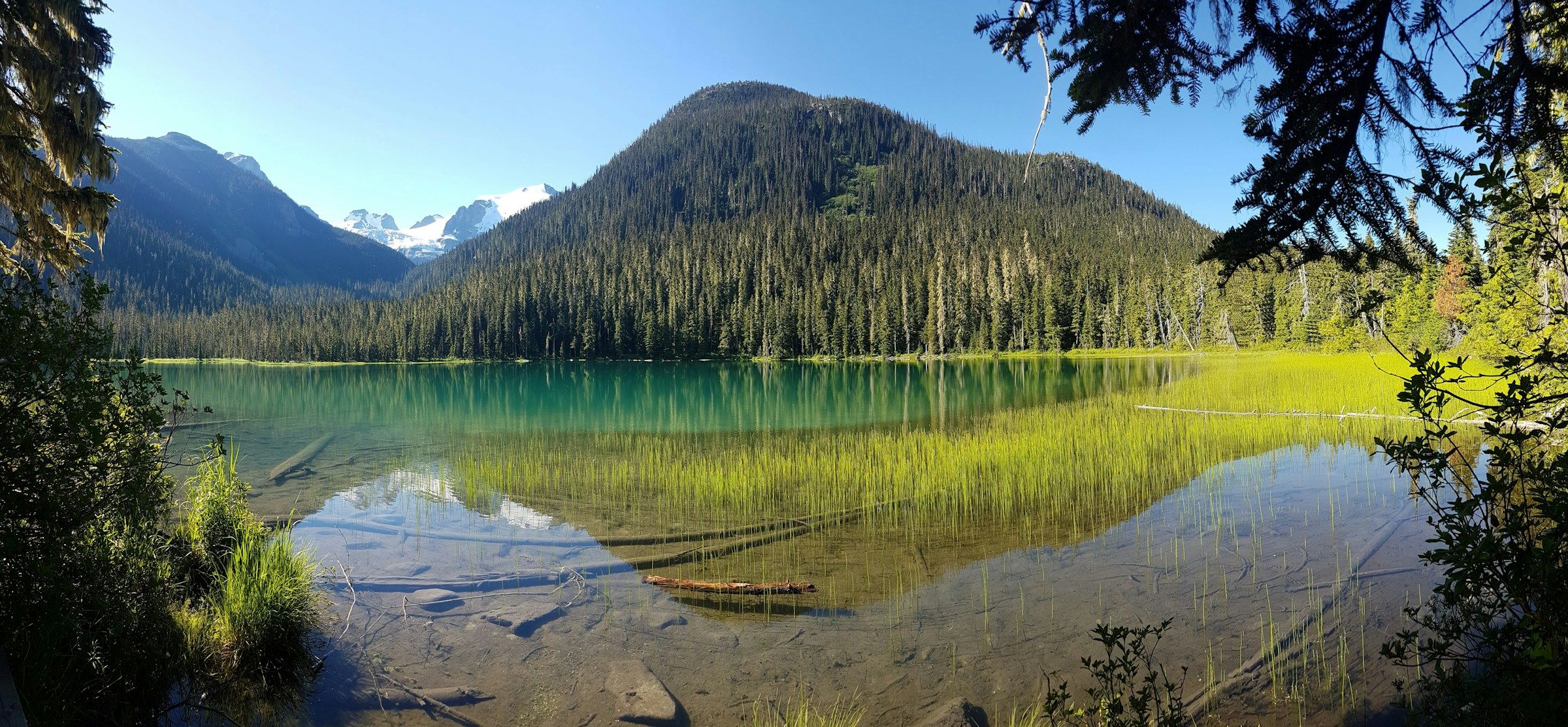
Twenty five minutes east of Pemberton, Joffre Lakes Provincial Park holds three glacier-fed lakes stacked up a valley below the Matier Glacier. The colour is real and it is startling. The hike is about 10 kilometres return with a steady climb to the upper lake.
It became so popular that BC Parks introduced a day-use pass system for peak season, released in advance and gone within minutes on summer weekends. The park has also closed for defined periods under agreements with the Lil'wat and N'Quatqua Nations, whose territory it sits in, so that traditional harvesting can take place. Those closures are announced in advance and they are not negotiable.
Check the current pass requirement, release times and any closure dates before you plan a day around it. The Canooq Pass and Parking Checker tracks BC Parks day-use pass releases, including how cancellations reappear, which is the practical way to get a pass after the initial batch has gone.
What else is worth stopping for
Duffey Lake
The lake the road is named after sits at the top of the route in its own small provincial park. There are pull-outs, a rough boat launch and a view down the length of the water. It is the calmest stop on the drive and usually the emptiest.
Cayoosh Creek
The highway follows the creek down the eastern side for around 40 kilometres. It runs hard in spring and the canyon narrows in places to almost nothing. Several unmarked pull-outs give access to the water.
Seton Lake
Just before Lillooet, a viewpoint looks down on Seton Lake, a long fjord-like body of water in a dry landscape. The contrast between the glacial blue water and the brown hills is the image that ends the drive.
Lillooet
The town at the end sits in one of the hottest and driest pockets in Canada, in the middle of the Fraser Canyon. It was Mile 0 of the Cariboo Wagon Road during the gold rush, and today it has fuel, food, a museum and a growing set of vineyards in a landscape that looks nothing like the coast you left two hours earlier.
The Duffey Lake Road in sections
Distances are approximate. Times exclude stops and assume dry conditions.
| Section | Distance | Note |
|---|---|---|
| Pemberton to Joffre Lakes | About 35 km | Steep switchback climb, park on the highway side |
| Joffre Lakes to Duffey Lake | About 20 km | The high section, snow lingers into June |
| Duffey Lake to Seton viewpoint | About 40 km | Long descent beside Cayoosh Creek |
| Seton viewpoint to Lillooet | About 10 km | Dry canyon country, first services |
When to drive it, and which direction
Late June through early October is the window where the road is at its best and the high section is clear of snow. July and August bring the Joffre Lakes crowds, which affects the parking at that one trailhead far more than it affects the drive. Late September is the pick: larches turning at elevation, the Lillooet vineyards in harvest, and the traffic gone.
Direction matters more than people expect. Driving west to east, from Pemberton to Lillooet, puts the steep climb at the start when brakes are cold and ends with a long descent into the dry country, which is the more forgiving order and the better sequence of views. Going the other way means climbing out of Lillooet in the heat and descending the switchbacks above Pemberton at the end of the day, when attention is lowest.
Whichever way you go, start early. The pull-outs are small, the light in the canyon is gone by mid-afternoon in autumn, and arriving at Joffre Lakes before eight is the difference between a parking space and a wasted hour.
Making it a loop
Driving out and back from Vancouver in a day is possible and long. The better version is a loop: up the Sea to Sky to Pemberton, over the Duffey to Lillooet, then south through Lytton and the Fraser Canyon on Highway 1, returning through Hope. That is a full weekend and it covers four distinct climate zones.
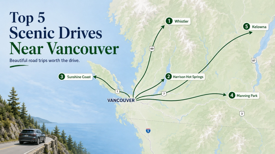
Our guide to scenic drives near Vancouver covers the shorter versions if a weekend is not available, and the day trips from Vancouver guide has the options that do not involve a mountain pass at all. The Experience Finder filters by trip length if you want to compare.
Plan the rest of the trip
Day-use passes, closures and highway conditions are the three things to check the morning you drive.
Common questions
Is the Duffey Lake Road dangerous?
Good conditions make Duffey technically straightforward, but the road is steep, remote and unforgiving of poor tires or overheated brakes. In winter it demands real winter driving experience.
Do you need a pass for Joffre Lakes?
In peak season BC Parks requires a free day-use pass booked in advance. Check current requirements and any cultural closure dates before you go.
How long does the drive take?
About two hours from Pemberton to Lillooet without stopping, or a full day with Joffre Lakes and the viewpoints included.
Is there fuel on the Duffey Lake Road?
No. Fill up in Pemberton or Lillooet. There is nothing in between.
Sources
Related travel guides:
Page details
Author: Thomas Tremblay
Updated: August 13, 2026
Last reviewed: August 13, 2026
Sources verified: August 13, 2026
Cite this page: Canooq.ca, The Duffey Lake Road: What to Know Before Driving Highway 99 to Lillooet, https://www.canooq.ca/travel/duffey-lake-road-guide
Canooq content is educational and may include affiliate or referral links. It is not financial, tax, legal, immigration, employment, mortgage, real estate, or healthcare advice. Verify official sources and provider terms before acting.
Enjoy Canooq? Let us keep helping you — make Canooq a preferred source on Google.