Driving the Viking Trail: Gros Morne to L'Anse aux Meadows

August 19, 2026
The Viking Trail runs from Deer Lake to the northern tip of Newfoundland, connecting Gros Morne and the only confirmed Norse site in North America.
What's on this page
Route 430 covers about 430 kilometres from Deer Lake to St. Anthony and links two UNESCO World Heritage sites. Five hours of driving without stops, five days with them. Book the Western Brook Pond boat and the L'Anse aux Meadows tour before you go, and plan every day around not driving at dusk.
Two UNESCO World Heritage sites sit at either end of one road in Newfoundland. At the southern end, Gros Morne, where the Earth's mantle is exposed at the surface and glacial fjords are cut into a plateau. At the northern end, L'Anse aux Meadows, the only confirmed Norse settlement in North America, roughly 500 years before Columbus.
The road between them is Route 430, the Viking Trail. It is about 430 kilometres from Deer Lake to St. Anthony, roughly five hours of pure driving, and anyone who tries to do it in a day has misunderstood the assignment.
How long it actually takes
Four days is the minimum that does not feel rushed. Five or six is better. The distances are not the problem. The problem is that the good things are spread evenly along the route and each one costs half a day.
- Days one and two. Gros Morne, based in Rocky Harbour or Norris Point.
- Day three. Drive north with stops at the Arches, Port au Choix and the coastal fishing communities.
- Days four and five. L'Anse aux Meadows, St. Anthony and the northern tip.
Most people fly into Deer Lake, which sits at the bottom of the route, rent a car there and drive north. Coming from the ferry at Port aux Basques adds about three hours to the start.
Gros Morne: two landscapes in one park
Gros Morne is two experiences separated by a ferry-free but slow drive around Bonne Bay. The southern side at Woody Point holds the Tablelands, a plateau of orange peridotite that is a piece of the Earth's mantle pushed to the surface. It looks like Mars, almost nothing grows on it, and the flat interpretive trail lets anyone walk on it.
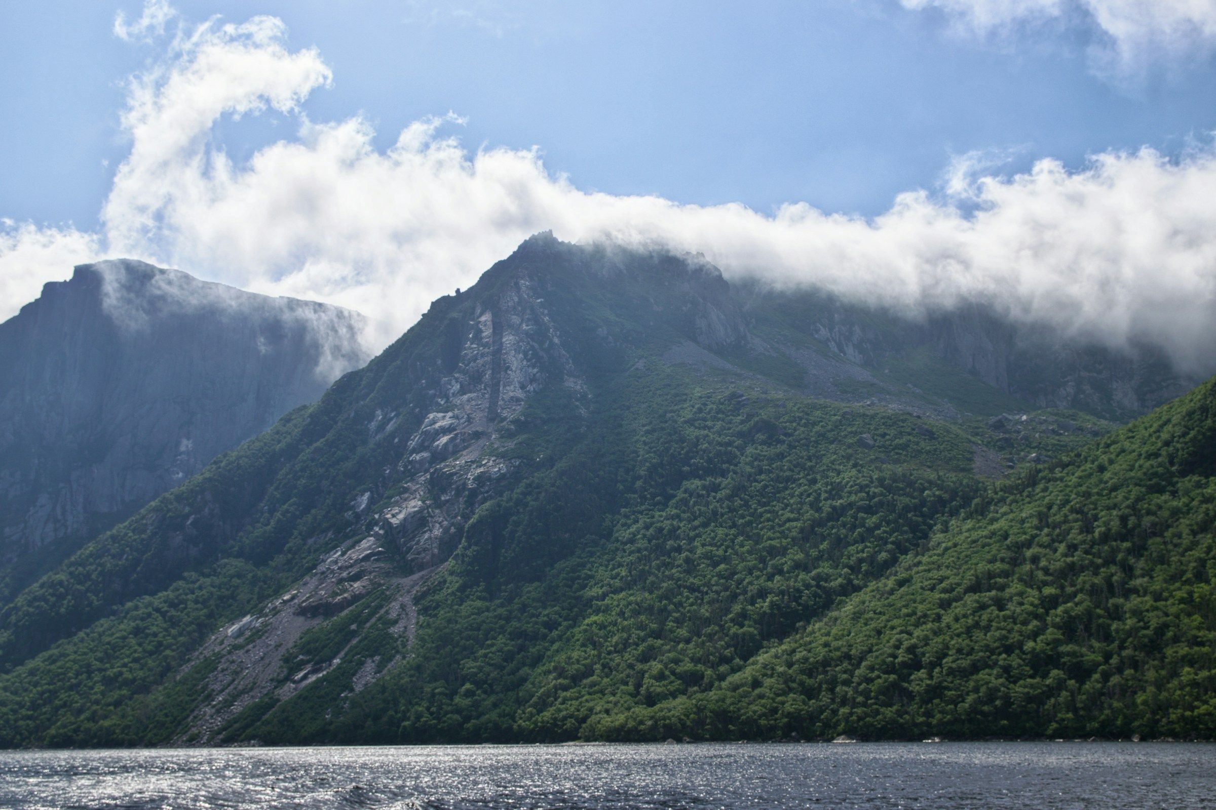
The northern side holds Western Brook Pond, a landlocked freshwater fjord with cliffs rising 600 metres from the water. Reaching it is a three kilometre walk across bog to the boat dock, then a two hour tour up the gorge. The boat books out in July and August, and the walk in takes 45 minutes each way, so allow four hours total.
If you want one hard day, the Gros Morne Mountain trail climbs a scree gully to the summit plateau and takes most of a long day. It closes in early summer to protect calving caribou. Green Gardens, with sea stacks and volcanic cliffs, is the underrated alternative.
The middle stretch: where the drive earns its name
North of Gros Morne, the road runs between the Long Range Mountains and the Gulf of St. Lawrence with almost nothing between it and the water. This is the part people remember. Fishing stages, drying racks, small harbours, and long empty sections where the limestone barrens meet the sea.
Stop at the Arches Provincial Park, where the sea has cut through a limestone headland. Port au Choix National Historic Site preserves burial grounds and settlements from four cultures over 5,500 years, and it is the most substantial archaeological stop before the Norse site itself. At St. Barbe, a ferry crosses to Blanc-Sablon on the Quebec and Labrador border, which is how you extend this into a much longer trip.
L'Anse aux Meadows: the reason the road has its name
At the northern tip, sod buildings sit on a low grassy shore facing the Labrador Sea. This is where Norse sailors landed around the year 1000, and where excavation in the 1960s produced the iron and the ring-headed pin that proved it. It became Canada's first UNESCO World Heritage site.
The Parks Canada site has an interpretive centre, the excavated foundations and reconstructed sod buildings with interpreters in role. Nearby, Norstead adds a full-scale Viking ship replica and a working village. Together they take a full day.
St. Anthony, half an hour away, is the service town and the base for icebergs and whales. Fishing Point has cliffside boardwalks where, in late spring and early summer, icebergs drift past close to shore. The Grenfell Historic Properties tell the story of the mission doctor who built the region's health system.
The Viking Trail in stages
Distances are approximate and stop times assume a normal pace rather than a rushed one.
| Stage | Distance | Driving | Time to allow |
|---|---|---|---|
| Deer Lake to Rocky Harbour | About 70 km | 1 hour | Two nights in Gros Morne |
| Rocky Harbour to Port au Choix | About 220 km | 2.5 hours | Half a day with stops |
| Port au Choix to St. Anthony | About 230 km | 2.5 hours | Half a day |
| St. Anthony to L'Anse aux Meadows | About 45 km | 40 minutes | A full day at the sites |
The practical warnings that matter here
- Moose. Newfoundland has one of the highest moose collision rates in the country. Avoid driving at dawn, dusk and after dark on this route. This is the single most important rule of the trip.
- Fuel. Fill up in the towns. Gaps of 100 kilometres or more without services are normal, and rural stations keep short hours.
- Season. Most of the historic sites and boat tours run from roughly June to late September. Outside that window the drive is beautiful and almost everything is closed.
- Weather. Fog and wind cancel boat tours. Build a spare day into the itinerary rather than assuming the sailing will run.
Park entry to Gros Morne is charged by Parks Canada, and a Discovery Pass covers it along with the national historic sites on the route. Check the current fee structure with the Pass and Parking Checker before you go, since combining park and site fees changes what is worth buying.
Where this fits among Canadian road trips
The Viking Trail carries more historical weight than almost any drive in Canada: two World Heritage sites, 5,500 years of human settlement and a coastline that has been fished continuously for centuries.
It appears on our list of Canada's UNESCO World Heritage sites twice, which no other road trip in the country manages, and Gros Morne earns its place among the best national parks for a first big trip. Use the Experience Finder to see how it compares with other multi-day routes by season and length.
Plan the rest of the trip
Park fees, boat sailings and seasonal openings drive the whole itinerary on this route.
Common questions
How many days do you need for the Viking Trail?
Four at an absolute minimum, five or six to do Gros Morne and L'Anse aux Meadows properly without spending every evening driving.
When can you see icebergs on the northern peninsula?
Typically late May through June, with the best viewing at St. Anthony and along the northern coast. Timing varies by year with ice conditions.
Is the Viking Trail paved the whole way?
Yes. Route 430 is paved from Deer Lake to St. Anthony, though the surface is rougher in places and shoulders are narrow.
Can you do the drive without renting a car?
Not realistically. There is no useful public transport along the route and the distances between sites are too long for anything else.
Sources
Related travel guides:

Page details
Author: Thomas Tremblay
Updated: August 13, 2026
Last reviewed: August 13, 2026
Sources verified: August 13, 2026
Cite this page: Canooq.ca, Driving the Viking Trail: Gros Morne to L'Anse aux Meadows, https://www.canooq.ca/travel/viking-trail-newfoundland-drive
Canooq content is educational and may include affiliate or referral links. It is not financial, tax, legal, immigration, employment, mortgage, real estate, or healthcare advice. Verify official sources and provider terms before acting.
Enjoy Canooq? Let us keep helping you — make Canooq a preferred source on Google.